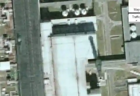
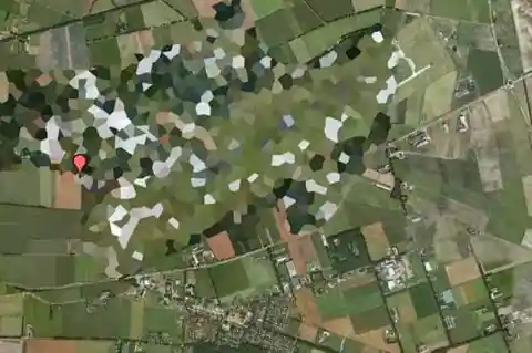
Decommissioned NATO Base
This may look like a normal picture, but don’t let them fool you! This is a different plot of land superimposed on top of the actual NATO facility. What a smart way of fooling the users, right?

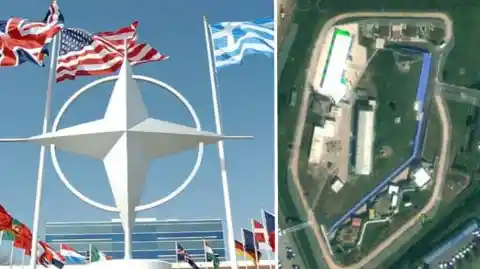
The base was deactivated in 2012, so what kind of stuff are they trying to hide? I mean, if it were just blurred, it wouldn´t be so suspicious, but designing a made-up facility? It sounds like a thing that would only happen in a TV series!
Baker Lake
The lake located in Nunavut, Canada, has been rumored to house extraterrestrials! The unexplained black strip over the entire lake is some kind of government cover-up, according to some theorists. What do you think?
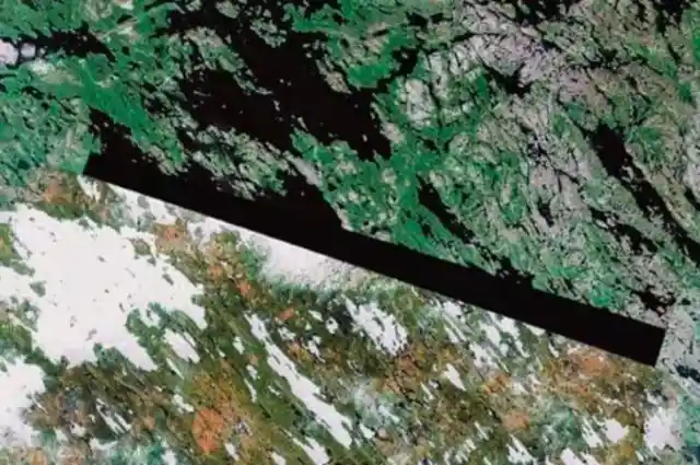
The lake is rumored to be one of the three extraterrestrial beacons that exert powerful electromagnetic fields. I know it sounds a little bit out there, but what other explanation is there to censor a whole lake?
Elmira Correctional Facility
Also knows as “The Hill,” the Elmira Correctional Facility is a maximum security state prison located in Elmira, New York. Maybe they don’t want anyone to see the facility because they could find some escape routes? Who knows.
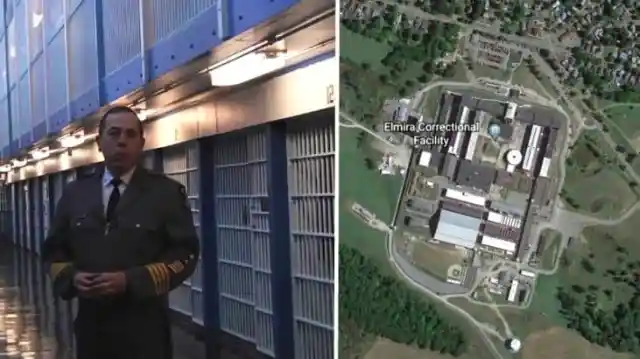
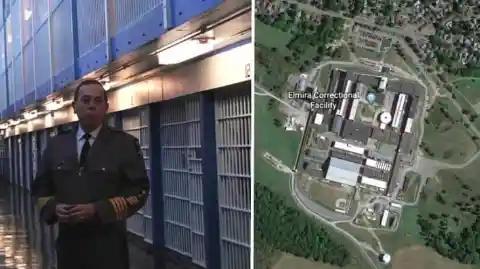
Some notable inmates are serving their time in the facility, like the rapper Trevell Gerald Coleman AKA G-Dep, sentenced to 15 to life. So maybe the reason behind this is to protect some celebrities’ privacy.
The Dutch Royal Palace
You can see everything surrounding the Dutch Royal Palace, but for some strange reason, the place is blurred. The tiny parked cars outside are visible, but the building cannot be seen. What secret is Amsterdam hiding?
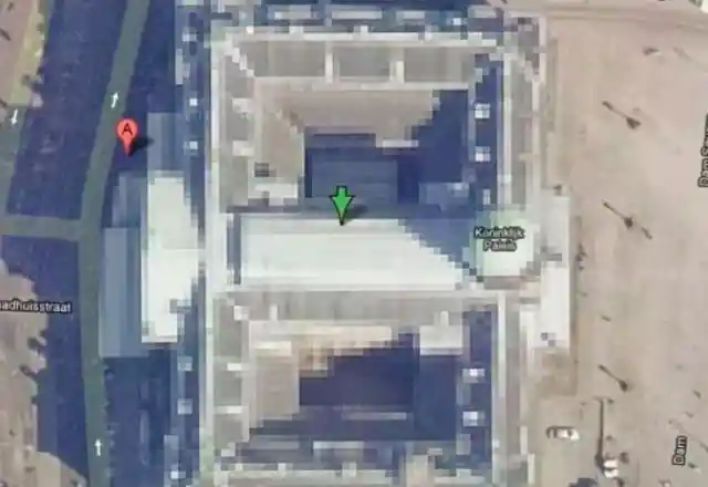
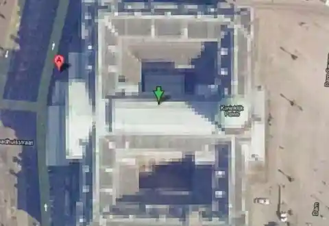
This building is one of the three palaces that are at the disposal of the Dutch monarch by Act of Parliament. Perhaps it is the Royal family who is trying to keep things undercover here.
Colonel Sanders
There is nothing better than seeing the KFC mascot while on a car ride. The promise of a tasty treat. But if you’re using Google Earth, the Colonel´s face is always blurred out. So why is this food chain taken off the menu by Google?
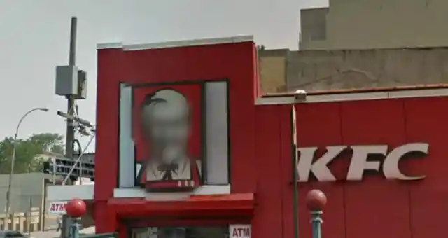
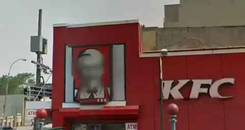
The mapping system recognized him as a person, perhaps? Google Maps does blur real people’s faces, but do they really confuse the KFC guy for a real-life fellow? If you ask me, this raises a lot of questions.
Cornell Hydroelectric Power Plant
This hydroelectric facility is located in Ithaca, New York, and it was built at the very base of Ithaca Falls. But while all the locals are proud of such an architectural masterpiece, anyone trying to catch a glimpse of it is going to be disappointed.

This highly acclaimed high-tech, eco-friendly facility generates electricity, and it’s aimed to lower the state’s carbon dioxide emissions. All this excitement, and we end up seeing a messy blur. What a shame!
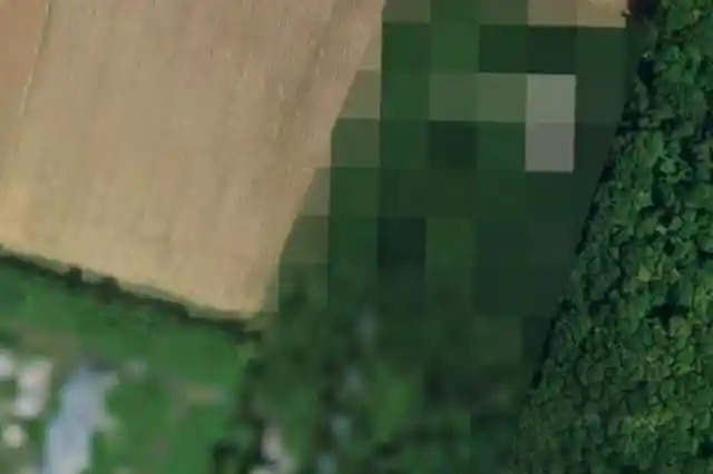
Parque Tantauco
This Chilean national park is astonishingly beautiful. It is privately owned, but why would that mean it has to be blurred? If you ask me, Chile’s President has some explaining to do here. What is there to hide?
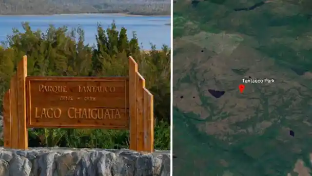

The park was created in 2005, years before the current president came into office, to protect the region’s unique ecosystem. So why is the park open to the public but off-limits to Google Maps users? It makes no sense at all!
Szazhalombatta Oil Refinery
Danube Refinery is located at Szazhalombatta, near Budapest, and it began operations in 1965\. The refinery has a capacity of 165,000 BPD of crude oil and is one of the largest ones in the region. But when you look it up on Google Earth, this is what you find.
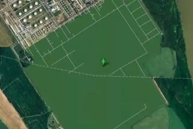

The most important refinery in Hungary is nothing but an empty green blankness! Are there any security reasons to obscure the images on Google? I know, nobody spends their free time looking at oil refineries on Google Earth, but still… weird.
Mazda Raceway Laguna Seca
The Mazda Raceway Laguna Seca is an 11-turn 2,238-mile race track located on California’s beautiful central coast. The legendary race track is one of the most popular race venues in the world. So why did it make it to this list?
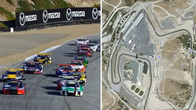
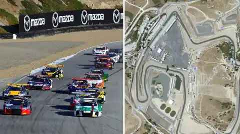
The race track seems to be edited, so there’s no way of watching where the races take place. Even if you want to watch the races on their website, it’s just not available. Why would they even bother?
Unites States Air Force Ramstein Air Force Base
During Operation Iraqi Freedom, this U.S. Air Force base in Germany was considered a potential target. It serves as headquarters for the United States Air Forces in Europe and also for NATO Allied Air Command.
It’s easy to see why the government would ask Google to have it blurred, even today. But still, it’s frightening that the world’s most powerful governments keep so many places a secret.
Mobil Oil Corporation Buildings
There’s some reason behind having some military facilities blurred. But what might a giant corporation have to hide at its facility in Buffalo? If you ask me, private companies shouldn’t even be allowed to this!

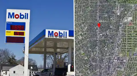
The oil and gas giant is trying to conceal some shady business from the public view. Something that has to do with the soaring gas prices, perhaps? The craziest part is that many of Mobil’s buildings are blurred; it’s not just one!
Minami Torishima Airport
This single-runway airport was built to serve the Japanese Maritime Defense Force. It was built back in the 1930s and was originally meant to be a meteorological center. However, Google Earth users can’t see it!

The weird part is that while this aerodrome on Minami Torishima Island used to be a military airstrip, it is no longer used for military purposes. But if this is the case, why does it remain hidden from view now?
Babylon
It is common to have large portions of oil facilities, or military areas blurred out, mainly for political or security reasons, I guess. But Iraq took it to the next level, don’t you think?
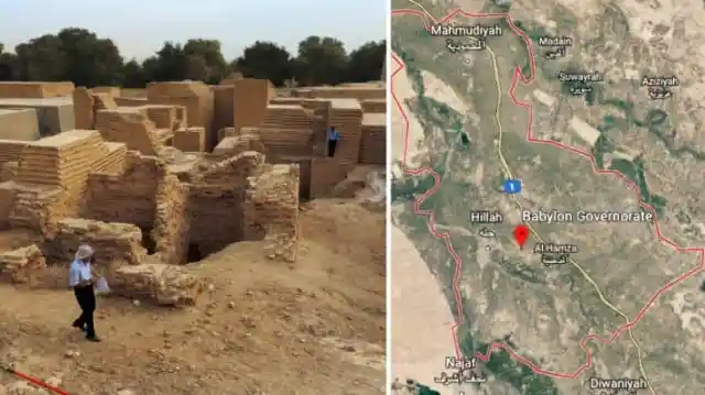

Believe it or not, an entire city is concealed from Google Earth users! The whole city of Babylon cannot be viewed, and no government official has ever commented on this. What’s the story with this?
Volkel Air Base
The government can request to have a site blurred for several reasons, for example, when they want to keep top secret information from prying eyes. Some operations are off-limits on Google Earth for that reason. But that’s not exactly what happened with Volkel Air Base.
Remember WikiLeaks? Well, it was awfully convenient that the site was blurred just after WikiLeaks published a cable claiming it housed nuclear warheads. If this were to be false, then what’s the need for blurring its facilities? Extremely suspicious…
Indian Point Nuclear Power Plant
Located on the banks of the Hudson River, the Indian Point Nuclear Power Plant is extremely off-limits. But not only that! When you try to look it up on Google Earth, instead of finding details of the facility, a warning message appears on your screen.
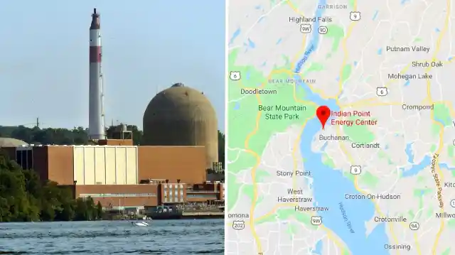
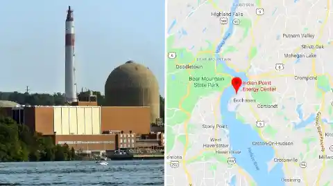
I know, there’s a reason why a working nuclear plant wouldn’t want people nosing around. But isn’t the warning message too much? I mean, it’s just Google Earth, for crying out loud!
Reims-Champagne Air Base
The pixelated results are supposed to be the government-owned Reims Air Base in Bétheny, France. Why would the government have it blurred when it has been permanently closed?

If nothing is going on any longer on the site, why is it off-limits? If you attempt to do a little research on the Front-line French Air Force airbase, you’ll get nowhere! I think government officials owe us an explanation.
North Korea
The supreme leader of the country is known for his crazy antics. So when he decided to cut off ties with the outside world, no one was surprised. That is why the whole country wasn’t showing up in any Google Earth searches.
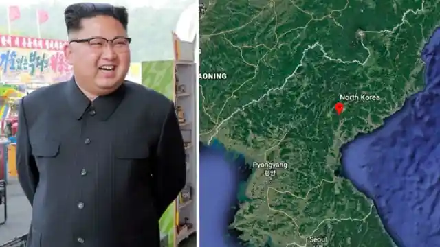

The reason might be all the inexplicable projects and abruptly postponed structures lying everywhere. But from what we hear from the few that speak up, some sinister deals are also happening that Kim won’t want you to know about.
Michael Aaf Building
The chemical weapons test site in Dugway, Utah, has been whited out ever since Google Earth was first introduced. But is there a reason behind it? Why were the company owners so keen on keeping the building a secret from the start?
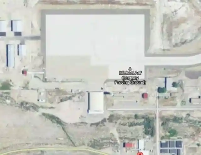
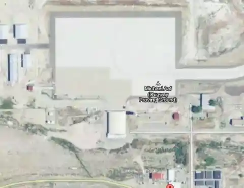
One could argue that a weapons test facility was probably blurred at a government request. There is some sense to it being off-limits for security purposes, but what’s the problem with people looking at the shape of the building?
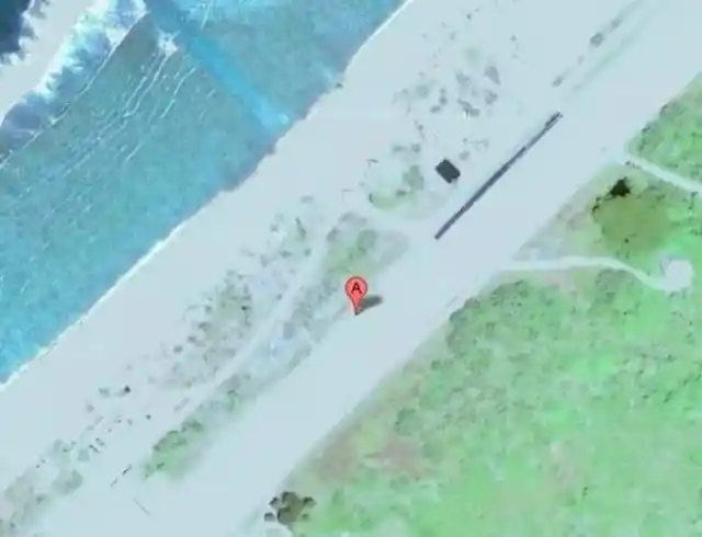
HAARP Site
The military site, also known as the “High-Frequency Active Auroral Research Program,” is located in Alaska. All sorts of conspiracy theories surround the place, from secret weapons being tested to it being a cover for a secret Area 51 UFO base.
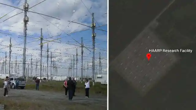

So when the place appeared to be mysteriously blurred on Google Maps, all conspiracy theorists felt redeemed. As you can observe in the image, all you can see are black shades. Who knows, maybe the mind control theories are right after all!
Keowee Dam
This dam located on the East Coast is capable of generating 40 megawatts, enough to power around 7,000 homes in South Carolina. The Keowee Dam runs a major East Coast power utility, so there is no reason to have it off-limits.
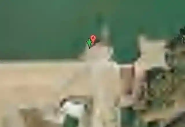
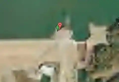
However, if you look it up on Google Earth, no search results are available. Even when there is some kind of explanation to the mystery, we’ll never know for certain! Some of the places on this list seemed awfully suspicious, don’t you think?